NASA Consortium awards funding to Virginia Tech's geospatial program
NASA has selected a partnership between the Virginia Space Grant Consortium (VSGC) and Virginia Tech to receive a $100,000 grant for geospatial education and work force development. The grant, awarded through the NASA Space Grant College and Fellowship program, allows the partners to continue the already successful Virginia Geospatial Extension Program that was established in July 2003.
VSGC and Virginia Tech received the funding as a result of the competitive evaluation of their plans to train local planners, Extension agents, state agency and other workers throughout Virginia in applying geospatial technologies.
Geographic Information Systems (GIS) are geospatial tools that allow users to precisely define any location on the face of the earth and then to add layers of information to describe what is at that location. It is a way to combine data from many sources about a specific area and to display it in a map format. Other geospatial tools include the application of the Global Positioning Systems (GPS) and remote sensing (satellite imagery and aerial photography) to provide innovative uses for local, state, and national needs.
GIS can provide a means to better understand a particular place or region in regard to such matters as economic development, site location, emergency response and public safety, regional planning, transportation planning, natural resource management, forest farming, precision agriculture, watershed/floodplain planning, and redistricting. GIS can save businesses and governments time and money.
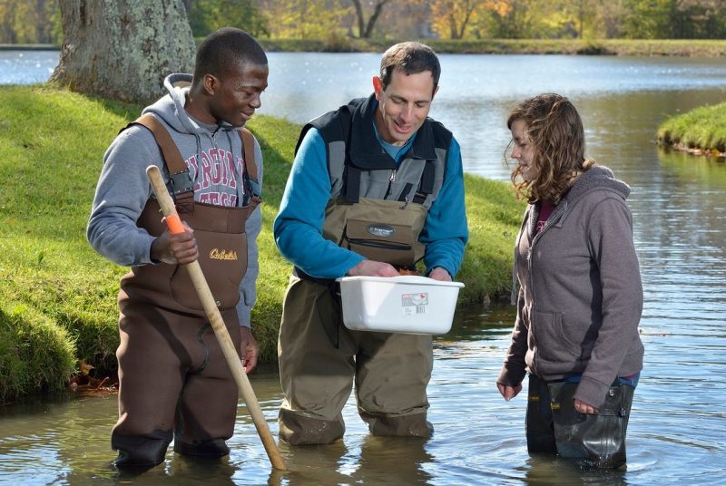
The $100,000 grant will enable John McGee, geospatial Extension specialist in the Department of Forestry in the College of Natural Resources and one of only 10 such specialists in the United States, to continue to facilitate efforts to bring geospatial applications to the grassroots level in the commonwealth.
One initiative is a circuit of workshops that the GEP is providing at New River Community College (March 25-26), Tidewater Community College (April 29-30), Piedmont Community College in Charlottesville (May27-28), Danville Community College (June 3-4), and Thomas Nelson Community College in Hampton (June 24-25). Topics covered in hands-on training will be ArcMap interface basics, attribute and data tables, digitizing and analyzing data, data sources, and Global Positioning System (GPS) and GIS.
McGee, who serves as a statewide resource for Extension agents, state agencies, local governments, and other end users, says the workshops are being held at the community colleges so that he can easily reach Extension staff and teachers, who can then teach students and others. "Our goal," explains McGee, "is to enable community college faculty to develop and teach GIS-specific courses so they begin to train students in this new field of work."
Brian Calhoun, assistant director of community initiatives for Cooperative Extension at Virginia Tech, notes, "The workshops will facilitate the efforts of local communities, educators, and businesses. Our end goal is to have a skilled workforce in place when modern technology companies are looking for a place to locate."
"The new technology also has applications for agriculture," adds Charlie Stallings, Extension associate director for agriculture and natural resources. "It can be used for such needs as crop insurance declarations and measuring crop land to estimate pesticide and fertilizer applications."
Partnering with Virginia Tech and the Virginia Space Grant Consortium in Virginia's Geospatial Extension Program are the Virginia Cooperative Extension, Virginia Community College System's Institute of Excellence for Advance Technology, Virginia Sea Grant, and the Virginia Geographic Information Network. Virginia Tech's on-campus partners include the forestry department in the College of Natural Resources, and the College of Agriculture and Life Sciences. NASA Langley Research Center, NASA Goddard Space Flight Center, and NASA Stennis Space Center participate on the project's Advisory Committee.
Anyone interested in registering for one of the workshops, which costs $225 can do so on the web: http://www.cnr.vt.edu/gep/. For additional information, contact Paige Baldassaro, Virginia Tech's geospatial applications developer, at (540) 231-5525 or pmb@vt.edu.
The worldwide market for geospatial technologies, currently estimated at $5 billion, is projected to have annual revenues of $30 billion by 2005, according to a NASA 2001 report. "The demand for workers with geospatial training is rapidly growing," says Mary Sandy, director of Virginia Space Grant Consortium. "All of our partners share the vision of how geospatial data and tools can improve resource management and yield economic and social benefits."
Founded in 1872 as a land-grant college, Virginia Tech has grown to become the largest university in the Commonwealth of Virginia. Today, Virginia Tech's eight colleges are dedicated to putting knowledge to work through teaching, research, and outreach activities and to fulfilling its vision to be among the top 30 research universities in the nation. At its 2,600-acre main campus located in Blacksburg and other campus centers in Northern Virginia, Southwest Virginia, Hampton Roads, Richmond, and Roanoke, Virginia Tech enrolls more than 28,000 full- and part-time undergraduate and graduate students from all 50 states and more than 100 countries in 170 academic degree programs.
The Virginia Space Grant Consortium is a coalition of Virginia Space Grant universities, state educational agencies, NASA centers and other organizations with a strong
interest in aerospace research and education. The Consortium works to enhance education and workforce development in science and technology fields, to ensure the most practical local application of NASA data, and to build university research infrastructure in the Commonwealth. For more information on the Virginia Space Grant Consortium, visit www.vsgc.odu.edu, or contact (757) 766-5210 or VSGC@odu.edu.